
.png)

Trail Conditions
Blue Hills Trail CONDITIONS
HINT: Reload this page to make sure you have the latest info.
Good hiking conditions - come shuffle through the leaves and enjoy the fading fall color.
Insect activity is low.
IMPORTANT UPDATES
snowfall
May 7: scant flurries
grooming & MOWING
Mowing Report / Plans:
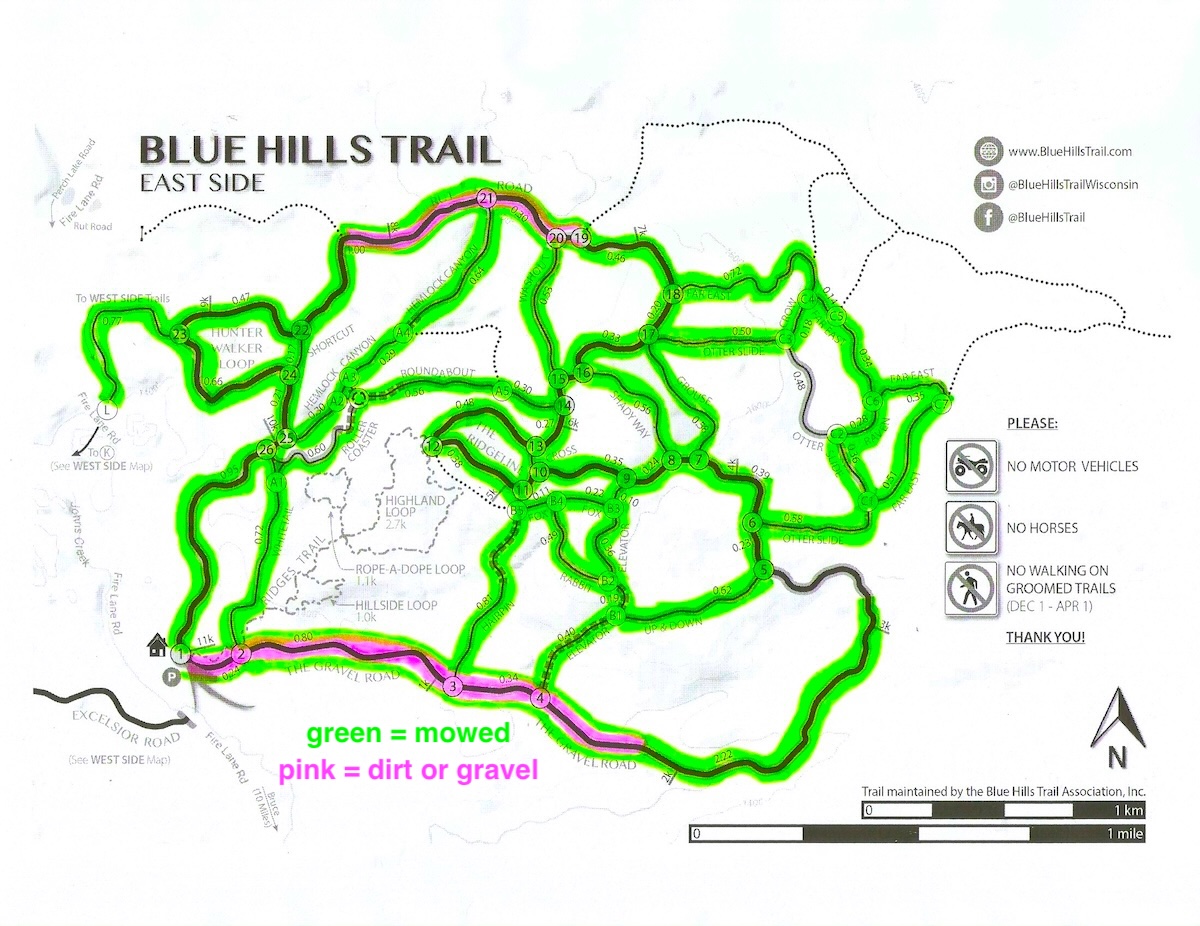
Mowing of the East Side trails began June 27th, and was completed September 20th.
The Rusk County Forestry Department mowed most of the West Side trails in August. The Blue Hills Trail Assn completed West Side mowing on October 7th.
weather forecast


We've updated the map for the West Side of our trail system (we have 2 maps: 'East Side' and 'West Side'). And we've switched to a different phone app for offline viewing of our maps.
A bit of history: for quite a few years, we've been able to offer our maps on the 'Avenza Maps' app that allowed visitors to accurately monitor their position using their smart phone. This was possible because instead of using cell towers, Avenza relied on world wide satellite monitoring of our cell phones. Knowing this, the Blue Hills Trail Assn generated GPS accurate maps that we uploaded to Avenza. As our trail system was modified to fit its surroundings, we modified our maps and placed them on Avenza for your use. Free.
Earlier this year (Spring of 2026), Avenza merged with another company -- and no longer allows users to upload maps to Avenza. So we couldn't upload our 'newly updated' West Side map.
Many previously satisfied Avenza users were very disappointed. We found one previous Avenza user in Chile that decided to create their own replacement, and recently set it up for world wide use. We jumped on board.
The new app (created especially for smart phone use in the field) is called FO Maps. We're happy to report that both of our trail maps are now available on the FO Maps app - find them here. Enjoy exploring the FO Maps app and discovering its functionality. Change is inevitable, and this change appears to be for the better.
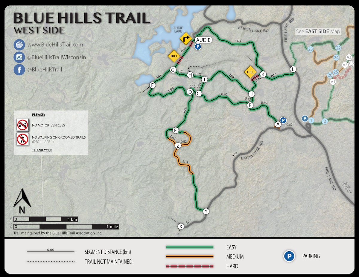
Image information: If you want to save any images from this blog post for yourself, simply right click the full size image to obtain the original. Higher quality images are available by contacting our website. To avoid copyright infringement, reprints must credit the Blue Hills Trail Association, Inc.
We've updated the map for the West Side of our trail system (we have 2 maps: 'East Side' and 'West Side'). And we've switched to a different phone app for offline viewing of our maps.
A bit of history: for quite a few years, we've been able to offer our maps on the 'Avenza Maps' app that allowed visitors to accurately monitor their position using their smart phone. This was possible because instead of using cell towers, Avenza relied on world wide satellite monitoring of our cell phones. Knowing this, the Blue Hills Trail Assn generated GPS accurate maps that we uploaded to Avenza. As our trail system was modified to fit its surroundings, we modified our maps and placed them on Avenza for your use. Free.
Earlier this year (Spring of 2026), Avenza merged with another company -- and no longer allows users to upload maps to Avenza. So we couldn't upload our 'newly updated' West Side map.
Many previously satisfied Avenza users were very disappointed. We found one previous Avenza user in Chile that decided to create their own replacement, and recently set it up for world wide use. We jumped on board.
The new app (created especially for smart phone use in the field) is called FO Maps. We're happy to report that both of our trail maps are now available on the FO Maps app - find them here. Enjoy exploring the FO Maps app and discovering its functionality. Change is inevitable, and this change appears to be for the better.
How to view images: To see larger versions of the thumbnail photos above, click on the thumbnail. If you want to save the image for yourself, simply right click the full size image to obtain the original. Higher quality images are available by contacting our website. To avoid copyright infringement, reprints must credit the Blue Hills Trail Association, Inc.
Blue Hills Trail
instagram updates
Subscribe to Newsletter Updates
Stay in-the-know about grooming updates, special events, news, announcements, volunteer days, and more. Rest-assured, we never sell or share your information.


