
.png)

Trail Conditions
Blue Hills Trail CONDITIONS
HINT: Reload this page to make sure you have the latest info.
Good hiking conditions - come shuffle through the leaves and enjoy the last of the fall color.
Insect activity is quite low.
IMPORTANT UPDATES
snowfall
May 7: scant flurries
grooming & MOWING
Mowing Report / Plans:
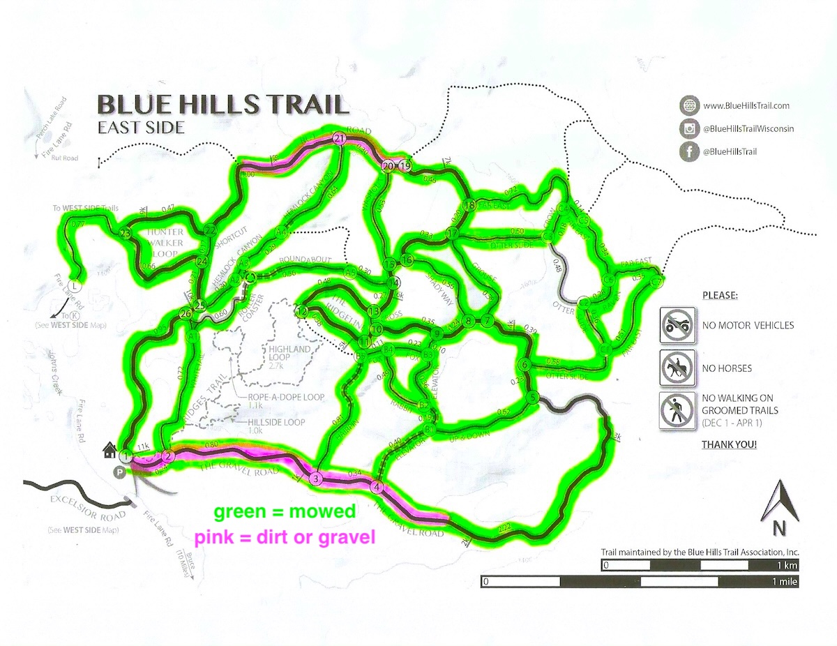
Mowing of the East Side trails began June 27th, and was completed September 20th.
The Rusk County Forestry Department mowed most of the West Side trails in August. The Blue Hills Trail Assn completed West Side mowing on October 7th.
weather forecast

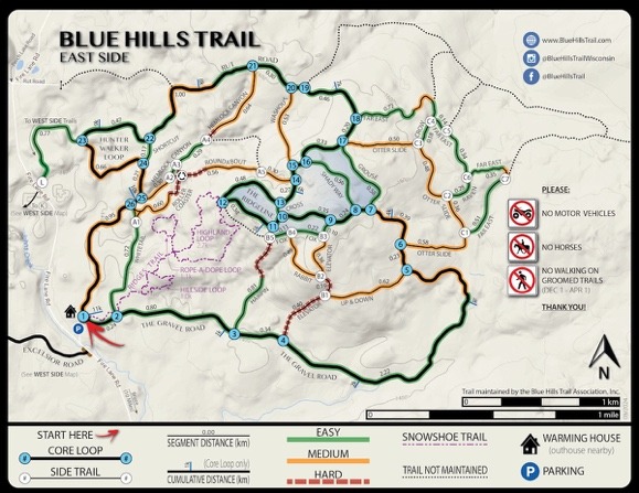
West Side Map for Phone Navigation
for offline use w/ smartphones via the FO Maps app
Get the FO Maps app, open a map, and explore a world of possibilities.
It's a good resource for navigating the Blue Hills Trail where satellites track your phone even when cell service is lacking!

Downloading and Using Maps for Offline Navigation

1 - Install the "FO Maps" app to your phone:
- Android: "Find 'FO Maps' on Google Play HERE"
- iPhone: "Find 'FO Maps' in the App Store HERE"
2 - Download maps using the ‘FO Maps’ app:
NOTE - for GPS-enabled offline use in the woods, download the maps to your phone before leaving cell service.
- Open the "FO Maps" app
- Open "DISCOVER" from the main menu, then select either "Near you" or "Organizations"
- For the "NEAR YOU" option, find and download the "Blue Hills Trail: East Side", and the "Blue Hills Trail: West Side" maps
- For the "ORGANIZATIONS" option, find the Blue Hills Trail Association, then download the "East Side" and "West Side" maps
3 - Use your downloaded maps for GPS-enabled offline navigation:
- Go to the main menu of the "FO Maps" app, select either "Maps & Projects" or "General Map", open the map of your choice
- The map will show multiple icons that are navigation tools. To hide the icons, tap anywhere away from the icons. Tap again to make the icons reappear.
- The most useful tool is knowing your location. Your location will show as a green dot or a blue arrow. To snap to your current location, select the crosshairs icon at the bottom right.

- Tap the other 'Crosshairs Icon' to switch between showing 1) North facing up, or 2) your current perspective.
- Another useful tool for you to trace your route is GPS Tracking.

- Play around with the rest of the navigation tools as you see fit!
- To make adjustments to various app parameters, select "Settings" in the main menu.
- To customize which navigation tools are shown on the map screen, select "Navigation Panel" from within the "Settings" menu.
Blue Hills Trail
instagram updates
Subscribe to Newsletter Updates
Stay in-the-know about grooming updates, special events, news, announcements, volunteer days, and more. Rest-assured, we never sell or share your information.


